

see also:
dynamics and numerics |
initial and boundary conditions |
physical parameterizations |
code and parallelization |
data assimilation
Last updated: September 2011
The parameterization of physical processes, but also the adiabatic model part requires some parameters which are not derived by data assimilation or by interpolation from a driving model. These so-called external parameters are defined in additional data sets.
Additional documentation is available to describe the raw data sets used for the generation of the external parameters.
Below, the external parameters that are currently needed by the COSMO-Model, are listed.
| Parameter | Short name | Unit | necessary, if ... |
|---|---|---|---|
| geometrical height | HSURF | m | necessary |
| geopotential | FIS | m2s-2 | optional (for HSURF) |
| land cover | FR_LAND | 1 | necessary |
| standard deviation of subgrid scale orogr. height | SSO_STDH | m | lsso=.TRUE. |
| anisotropy of topography | SSO_GAMMA | 1 | lsso=.TRUE. |
| angle betw. principal axis of orogr. and global E | SSO_THETA | 1 | lsso=.TRUE. |
| mean slope of subgrid scale orography | SSO_SIGMA | 1 | lsso=.TRUE. |
| surface roughness | Z0 | m | necessary |
| soil texture | SOILTYP | 1 | necessary |
| surface emissivity (long wave) | EMISS_RAD | 1 | lemiss=.TRUE. |
| root depth | ROOTDP | m | necessary |
| vegetation (plant cover) | PLCOV | % | necessary |
| ground fraction covered by plants (time of rest) | PLCOV_MM | 1 | necessary |
| ground fraction covered by plants (vegetation p.) | PLCOV_MX | 1 | necessary |
| ground fraction covered by evergreen forest | FOR_E | 1 | lforest=.TRUE. |
| ground fraction covered by deciduous forest | FOR_D | 1 | lforest=.TRUE. |
| leaf area index (time of rest) | LAI_MN | 1 | necessary |
| leaf area index (vegetation period) | LAI_MX | 1 | necessary |
External parameters for the COSMO-Model can be derived by a preprocessor program for any domain on the globe at (nearly) any required spatial resolution (but not below 2 km). However, this is very time consuming because of the size of the high-resolution global data sets. Within the COSMO group, we thus have some predefined data sets with external parameters on three different domains. The domains are defined with a different rotation, which is specified in the table below. The data sets for these domains are available on the COSMO ftp-server.
| Domain | Data Set | Grid Size | Degrees | Meters | pollon | pollat |
|---|---|---|---|---|---|---|
| Domain d0 | cosmo_d0_02800_1605x1605.g1_2007082400 | 1605x1605 | 0.025 | 2800 | -170.0 | 40.0 |
| Domain d1 | cosmo_d1_07000_961x769.g1_2009121700 | 961x769 | 0.0625 | 7000 | -170.0 | 32.5 |
| cosmo_d1_14000_481x385.g1_2009121700 | 481x385 | 0.125 | 14000 | -170.0 | 32.5 | |
| cosmo_d1_21000_321x257.g1_2009121700 | 321x257 | 0.1875 | 21000 | -170.0 | 32.5 | |
| cosmo_d1_28000_241x193.g1_2009121700 | 241x193 | 0.25 | 28000 | -170.0 | 32.5 | |
| cosmo_d1_56000_121x113.g1_2009121700 | 121x113 | 0.5 | 56000 | -170.0 | 32.5 | |
| Domain d5 | cosmo_d5_07000_965x773.g1_2009121700 | 965x773 | 0.0625 | 7000 | -170.0 | 40.0 |
| cosmo_d5_14000_483x387.g1_2009121700 | 483x387 | 0.125 | 14000 | -170.0 | 40.0 |
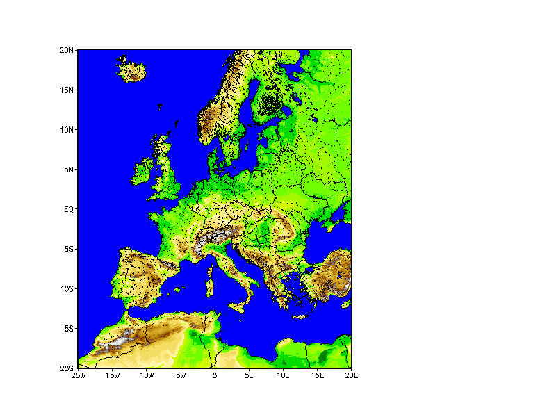
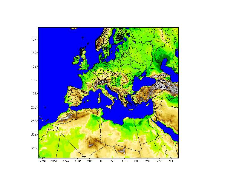
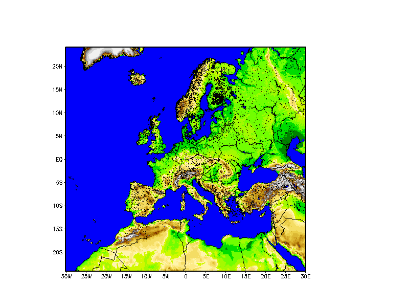
The following figures show the areas for the domains d0, d1 and d5 (left to right):


Domain d1 covers Europe and surrounding countries; data sets for this domain are available at 56 km, 28 km, 21 km, 14 km and 7 km grid spacing. They were generated for a rotated grid with its north pole at 32.5o latitude and -170.0o longitude. Such rotation was used at for the first operational implementation of the COSMO-Model (the "LM"). When introducing the COSMO-EU (the bigger domain), DWD switched to a rotated grid with the north pole at 40.0o latitude and -170.0o longitude. Data sets for this rotation are available for Domain d5 and 14 and 7 km resolution. The data set for domain d0 is provided for the resolution of about 2.8 km and has the same rotation as the ones for d5, but the domain is smaller.